Tropical Storm “Hagupit” to Enter PAR This Weekend and To Be Named “Caloy”
CALOY PH – Tropical Storm “Hagupit” is expected to enter the Philippine Area of Responsibility this weekend.
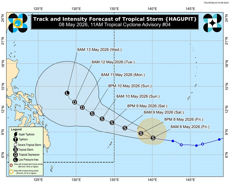
On Friday morning (May 8, 2026), the Philippine Atmospheric, Geophysical and Astronomical Services Administration (PAGASA) said that Tropical Storm “Hagupit” may enter PAR this weekend and will be given the local name “Caloy” once it enters the country’s monitoring area.
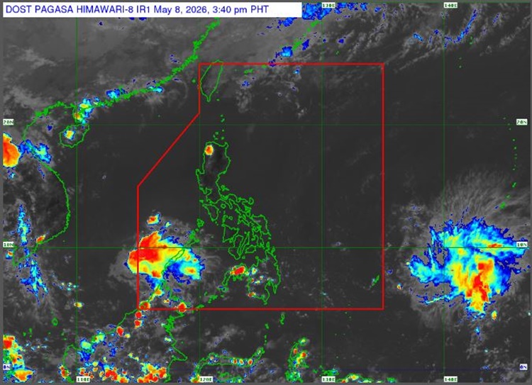
In its latest weather advisory, PAGASA said the center of the storm was last spotted about 1,615 kilometers east of northeastern Mindanao.
The tropical storm currently has maximum sustained winds of up to 75 kilometers per hour near the center and gustiness reaching 90 kilometers per hour. It is moving westward at a speed of 20 kilometers per hour.
According to the state weather bureau, the storm is expected to continue moving westward over the next several hours before slightly changing direction toward the west-northwest. Weather experts said the system may enter the PAR by Saturday evening (May 9) or early Sunday morning (May 10).
PAGASA also said that “Hagupit” could strengthen into a high-end tropical storm within the next 48 hours. However, it may weaken again and possibly become a tropical depression by Tuesday while moving over the Philippine Sea.
The weather agency explained that the possibility of the storm directly affecting the country’s weather and coastal conditions within the next three days remains low.
Meanwhile, the weather bureau is also monitoring a low-pressure area located about 120 kilometers southeast of Hinatuan, Surigao del Sur. Although the weather disturbance has a low chance of developing into a storm, it is expected to bring cloudy skies, scattered rains, and thunderstorms in several parts of the country.
Authorities continue to advise the public to stay updated with weather bulletins and prepare for possible changes in weather conditions during the weekend.
The social media users expressed their reactions to the post:


