
PAGASA Releases Latest Weather Update for Wednesday (August 19, 2026)
PAGASA WEATHER UPDATE – The state weather bureau reported that Tropical Depression Neneng has slightly intensified.
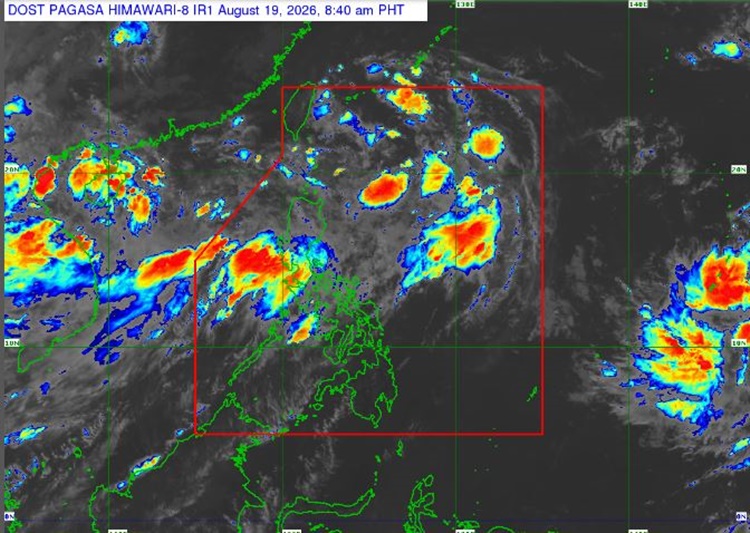
On Wednesday (August 19, 2026), the Philippine Atmospheric, Geophysical, and Astronomical Services Administration released the latest weather update in the country. Tropical Depression Neneng will continue to affect the country’s weather conditions.
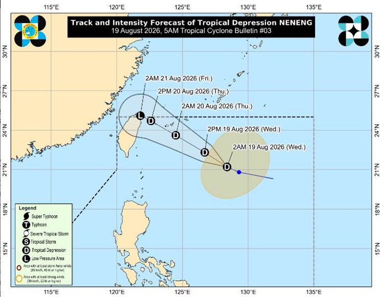
PAGASA weather specialist Chenel Dominguez reported that Neneng was located 675 kilometers east of Itbayat, Batanes. It has maximum sustained winds of 55 kilometers per hour and gustiness of up to 70 kph, moving 15 kph at a northwestward direction.
“Neneng will remain a tropical depression in the next 36 hours before weakening into a remnant low over or near Taiwan on Friday morning. However, earlier weakening into a remnant low is not ruled out,” PAGASA said.
The southwest monsoon will bring rains over Luzon and western sections of Visayas such as Aklan and Antique.
Fair weather conditions with chances of localized thunderstorms are expected over the rest of Visayas and Mindanao.
Meanwhile, two tropical depressions are being monitored outside the Philippine Area of Responsibility. A tropical cyclone located 670 km west of Calayan, Cagayan will not directly affect the country.
The other one was estimated 3,090 km east of Northeastern Mindanao and will enhance the southwest monsoon.
The coastal water conditions over the northern and western sections of Luzon will be moderate to rough. The rest of the country is expected to experience slight moderate surrounding sea conditions, according to PAGASA.
This is a developing report, just visit this website regularly or refresh the page for further updates.