
PAGASA Says Tropical Storm Isang Left PAR
PAGASA LATEST UPDATE – The state weather bureau reported that Isang develops into a tropical storm before leaving PAR.
On Saturday (August 23, 2025), the Philippine Atmospheric, Geophysical, and Astronomical Services Administration released the latest weather update in the country. Tropical Storm Isang will affect the country’s weather conditions.
PAGASA reported that Tropical Storm Isang exited the Philippine Area of Responsibility. Isang was last spotted 290 kilometers west of Bacnotan, La Union.

Isang has maximum wind speeds of 65 km per hour and gusts of up to 80 kph while moving westward at 25 kph. The tropical storm left PAR at 6:30 a.m.
“Tropical Storm Isang will continue moving westward throughout the forecast period… It will gradually intensify and may reach typhoon category while approaching the waters south of Hainan, China,” Pagasa said.
The weather disturbance will bring cloudy skies, scattered rains, and thunderstorms over the Cordillera Administrative Region. The LPA’s trough will bring similar weather conditions over Eastern Samar, Dinagat Islands, Surigao del Norte, Surigao del Sur, and Davao Oriental.
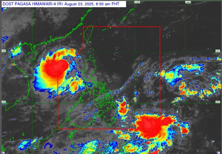
The southwest monsoon will affect the weather over Occidental Mindoro, Metro Manila, Central Luzon, CALABARZON, the rest of Visayas, and the rest of MIMAROPA, Bicol Region, and the rest of Mindanao.
The localized thunderstorms are expected over the rest of Luzon.
PAGASA also raised Tropical Cyclone Wind Signal No. 1 in the follow ing areas:
- The northern portion of Pangasinan
- The western portion of Cagayan
- The western portion of Isabela (Cordon, Ramon, San Mateo, Aurora, San Manuel, Roxas, Mallig, Quezon, Santa Maria)
- The northwestern portion of Nueva Vizcaya (Bayombong, Ambaguio, Villaverde, Kayapa, Santa Fe, Aritao, Bambang, Solano, Bagabag, Diadi)
The coastal water condition throughout the country will be slight to moderate, according to PAGASA.
RELATED ARTICLE: PAGASA Releases Latest Weather Update for Friday (August 22, 2025)